

Natural values
The Tamar estuary and Esk rivers play an important role in supporting the biodiversity of northern Tasmania.

Wetlands and mudflats
Wetlands are areas of land that are flooded by water, either permanently or seasonally, and have an amazing ability to clean water. As water moves slowly through the diverse plant communities, there is time for sediment to drop out of the water, along with other contaminants that are bound to them. Wetlands recycle pollutants such as nutrients which can be buried in the sediment and later utilised by plants as they grow.
Wetlands support an abundance of diverse species. Plentiful food as well as shelter, means that wetlands are important nursery sites for fish, crustaceans, and other organisms. The Tamar Island Wetlands near Launceston, is a wonderful example of a diverse and abundant tidal wetland, supporting vulnerable and rare species of birds, reptiles, amphibians and plants. The Tamar Island Wetlands Reserve is within an internationally-recognised Important Bird Area, as well as being a biodiversity hotspot. Migratory birds travel across the globe along the East Asian – Australian flyway.
It is not only aquatic / estuarine species that benefit from wetlands. Wetlands also act as natural sponges, storing water and slowly releasing it, thereby reducing the intensity, and spread of flood waters into urban areas. Furthermore, wetlands have been recognised for their effectiveness in sequestering and storing atmospheric carbon as ‘blue carbon’.

Saltmarsh
In 2013, coastal saltmarsh was recognised as a nationally-threatened vegetation community. Northern Tasmania hosts significant areas of coastal saltmarsh including 86 hectares of saltmarsh along the banks of the Kanamaluka / Tamar estuary, all within 45 minutes of Launceston. Like other wetland habitats, saltmarsh communities provide important benefits to plants, animals, and human communities. Saltmarsh helps to stimulate the productivity of the estuary through nutrient cycling. They also help to mitigate the threat of climate change and flooding. Saltmarshes are better at sequestering carbon than equivalent forested areas, and act as a ‘buffer’ against flooding by soaking-up and slowly releasing flood waters.

Protected areas
Protected areas in Australia are defined under categories set out by the International Union for the Conservation of Nature (IUCN). Classed as either Nature Reserves or Conservation Areas under the National Parks and Reserves Management Act 2002, the Kanamaluka / Tamar estuary contains 11 protected reserves, historic sites, and conservation areas which are home to 63 threatened plant species, 36 threatened animal species, and 20 migratory bird species.
Sharks in particular play an important role in the aquatic ecosystem, being apex predators and helping to maintain a balanced food web. All areas of the Kanamaluka / Tamar estuary south of Low Head are included in a Protected Shark Refuge Area. This recognises the importance of the estuary as a habitat for breeding of school and gummy sharks, skates, and rays, and prohibits the taking of any shark, skate, or ray from the estuary.
Important Bird Area
Birdlife International has listed the water and intertidal mudflats of the Kanamaluka / Tamar estuary from Launceston to Batman Bridge as an Important Bird Area (IBA), recognising the importance of the mudflats to shorebirds.
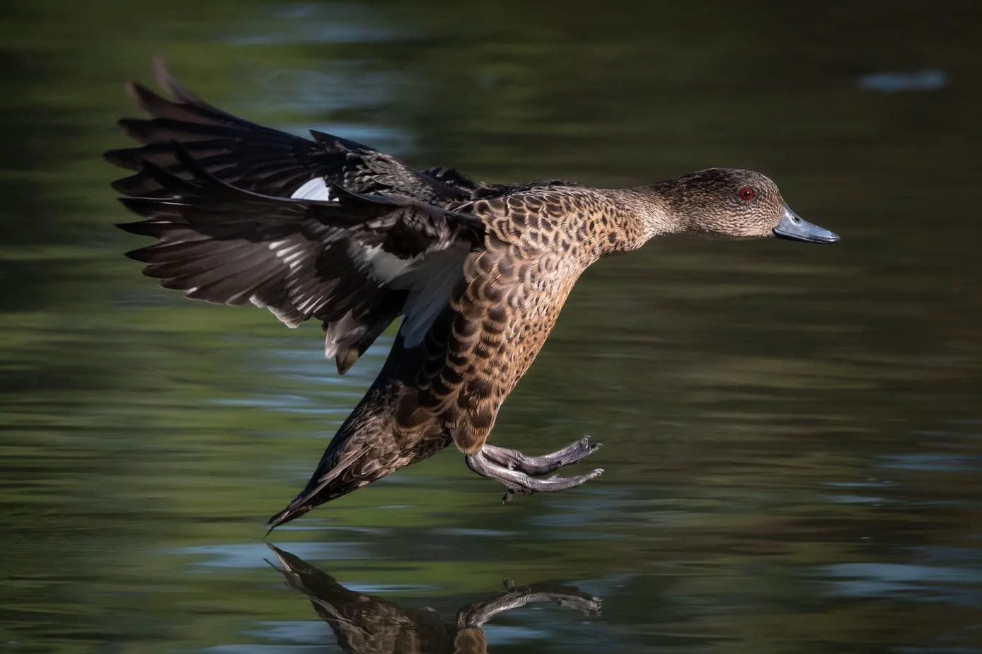
The presence of more than one per cent of the chestnut teal (Anas castanea) and pied oystercatcher (Haematopus longirostris) populations utilising the Kanamaluka / Tamar estuary during a key stage of their life cycle has also resulted in the recognition of the area as a Key Biodiversity Area by Birdlife Australia.
The Kanamaluka / Tamar estuary forms part of the East Asian – Australian flyway - a migratory corridor for birds which extends from breeding grounds in the Russian Tundra, Mongolia, and Alaska.
Riparian vegetation
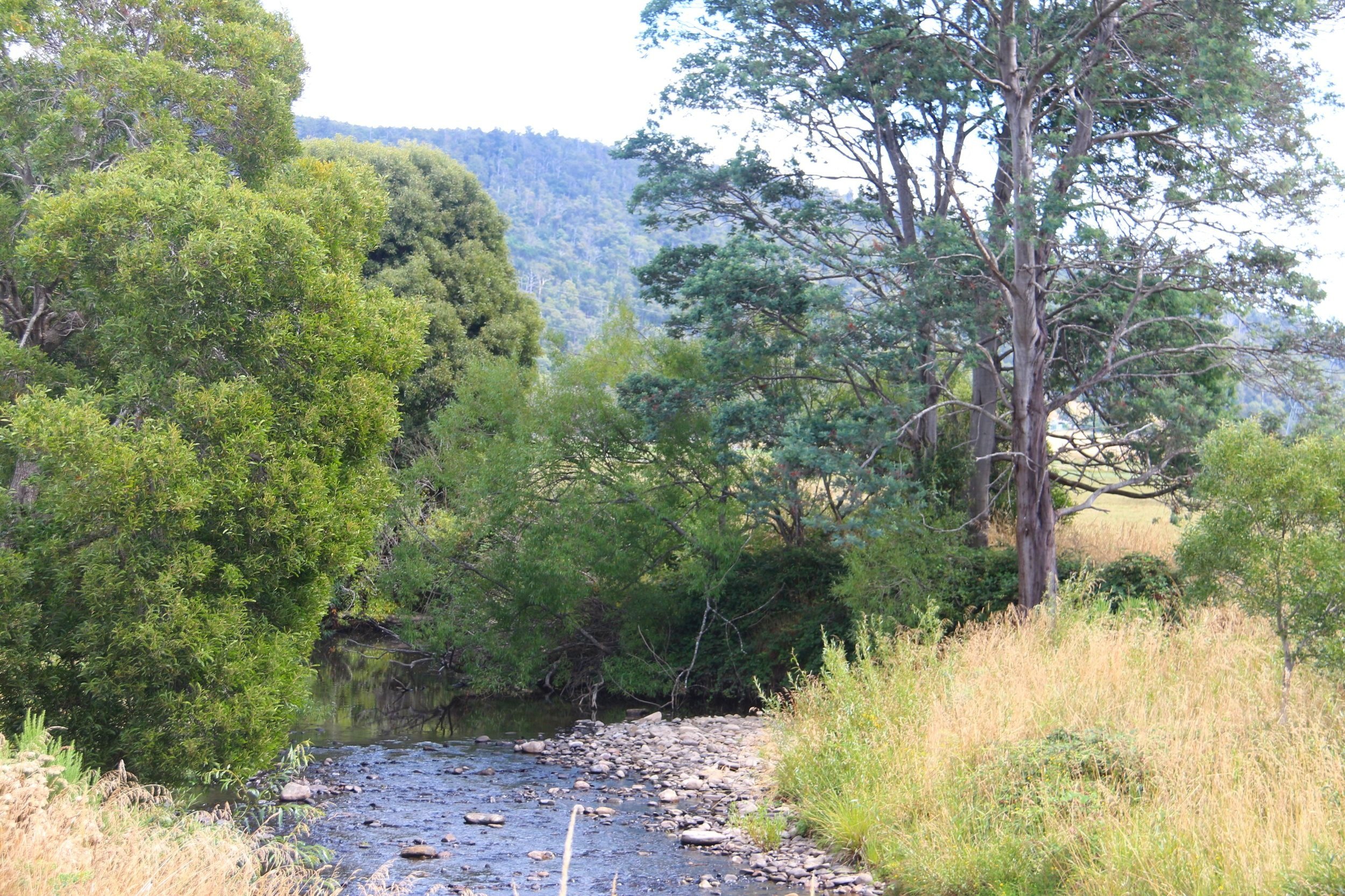
The riparian zone is the area of land that adjoins riverbanks, floodplains, lake foreshores, and wetland fringes. Due to the presence of water and nutrients in riparian zones, this land often supports significant plant communities which are generally denser and faster growing, and are essential for maintaining a healthy ecosystem.
Riparian vegetation helps to prevent pollutants on-land such as nutrients, pathogens, and pesticides entering waterways through run-off. Pollutants can attach to sediment particles which run-off the land with water; riparian vegetation traps this sediment, and the attached pollutants, before it enters the water. Riparian vegetation also reduces the risk of bank erosion and stabilises the water temperature by shading.